|
Melbourne / Victorian Photographs
in the collection of the National Gallery of Victoria (NGV)
Richard Daintree was in Victoria between 1852 and 1864. He arrived in 1852 for the gold rush, later working as a geologist for the Victorian Geological Survey (1854–1856, 1857–1864) and pioneering field photography. These photographs are from that period in Victoria. He briefly returned to England in 1856–1857 before moving to Queensland in 1864.
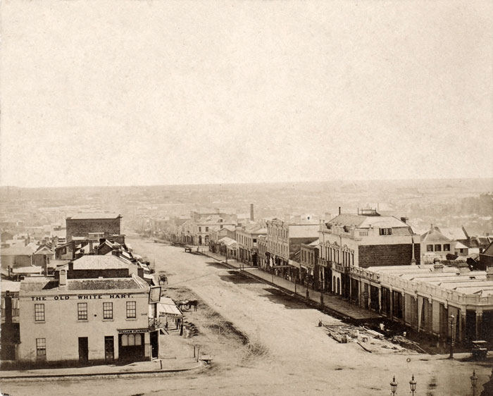 |
| NGV Collection, Richard Daintree: Burke Street from Parliament House, Melbourne |
| |
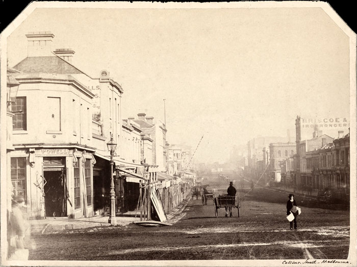 |
| NGV Collection, Richard Daintree: Collins Street, Melbourne |
| |
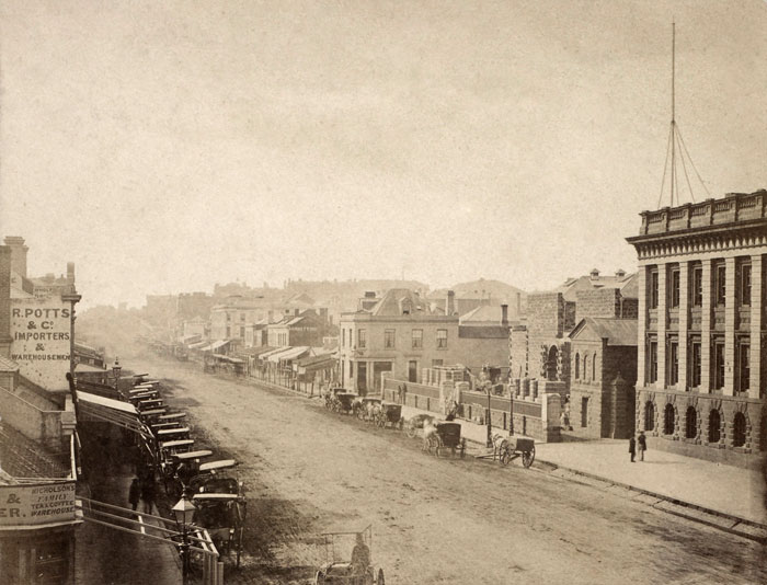 |
| NGV Collection, Richard Daintree: Swanston Street, Melbourne |
| |
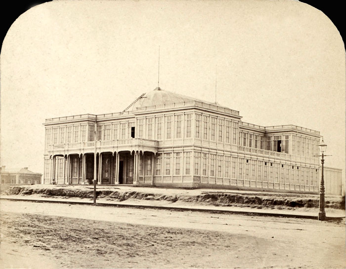 |
| NGV Collection, Richard Daintree: Exhibition Building Melbourne |
| |
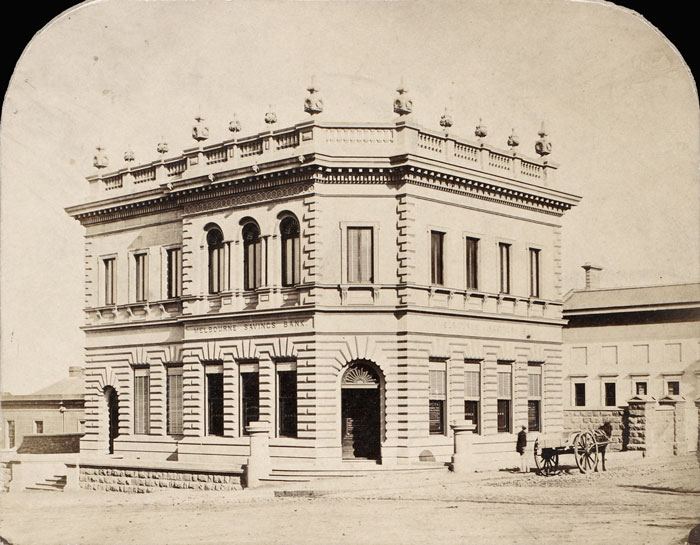 |
| NGV Collection, Richard Daintree: Melbourne Savings Bank |
| |
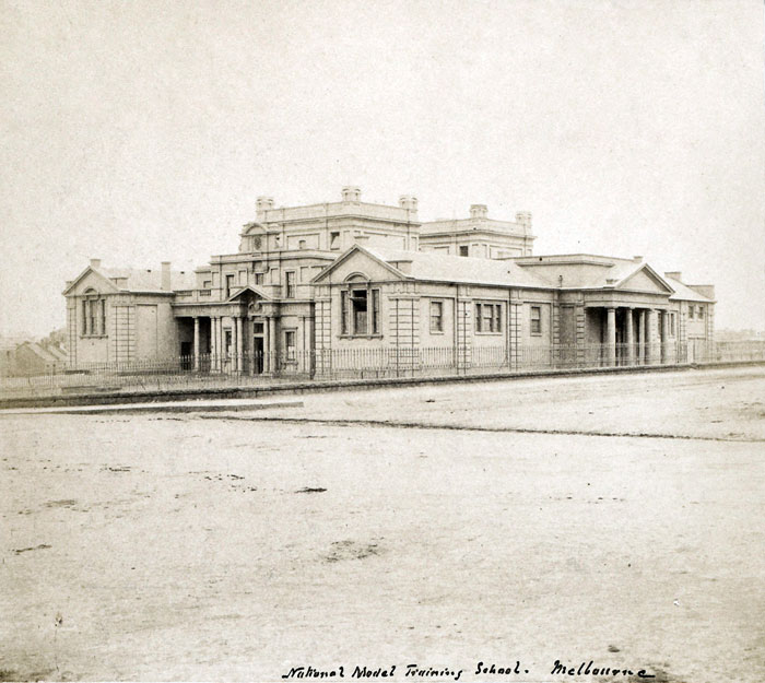 |
| NGV Collection, Richard Daintree: National Model Training School, Melbourne |
| |
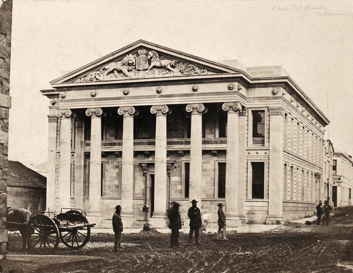 |
| NGV Collection, Richard Daintree: Oriental Bank, Melbourne |
| |
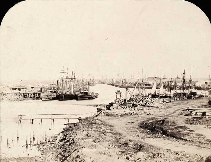 |
| NGV Collection, Richard Daintree: Yarra River below the falls, Melbourne |
| |
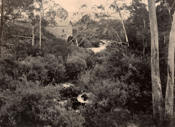 |
| NGV Collection, Richard Daintree: 1958, Willis Mills on the Plenty River |
| |
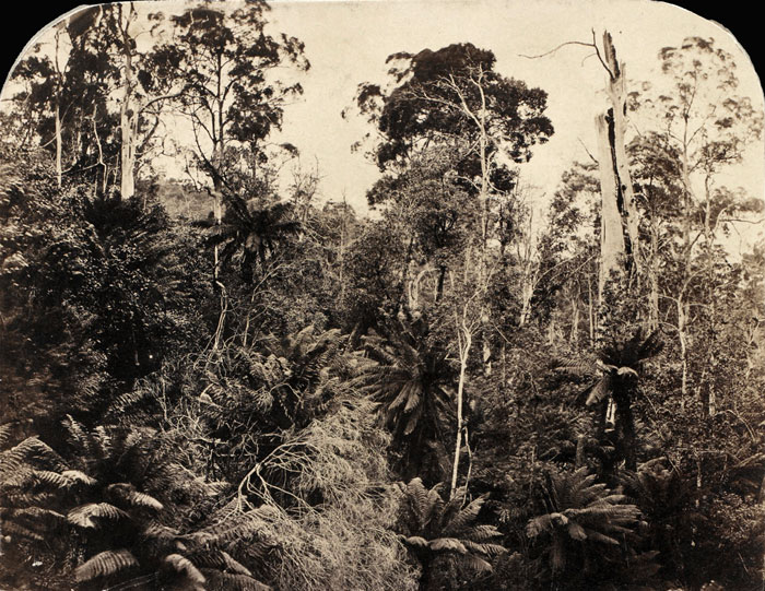 |
| NGV Collection, Richard Daintree: View in Ferntree Gully, Dandenong Ranges |
| |
 |
NGV Collection, Richard Daintree: Upper Palaeozoic resting uncomfortably on Lower Ordovician
Werribee River, 4 or 5 miles above Bacchus Marsh |
| |
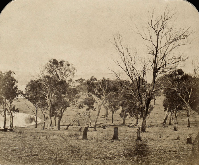 |
| NGV Collection, Richard Daintree: open forest country near Yan Yean (Victoria) |
| |
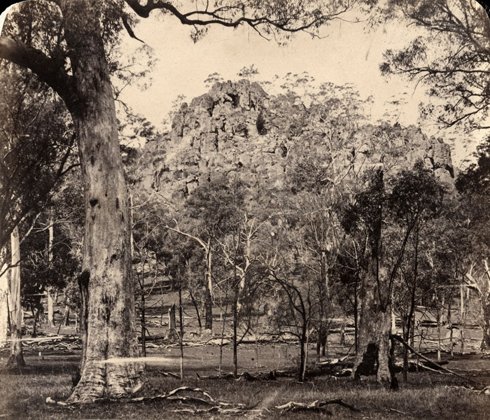 |
NGV Collection, Richard Daintree: Drysden Rocks Mount Macedon (Victoria)
Note: Known as Ngannelong to the traditional owners (Dja Dja Wurrung, Woi Wurrung, and Taungurung people). It was named Dryden's Rock in the mid-19th century after a local settler.
"Dryden’s Rock" or "Dryden's Mount," is a distinct 6.25-million-year-old volcanic formation (mamelon) located near Mount Macedon in Victoria, Australia. Named after early settler Edward Dryden, it is 71 meter-high.
The area is today famous because of Joan Lindsay's 1967 fictional story of The Picnic at Hanging Rock that featured the mysterious disappearance of three shool girls and their teacher while on a picnic on Valentine's Day 1900. The landmark gained fame through the 1975 film Picnic at Hanging Rock. It is now a very popular site for hiking, picnics, and horse racing. |
| |
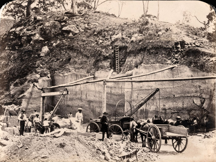 |
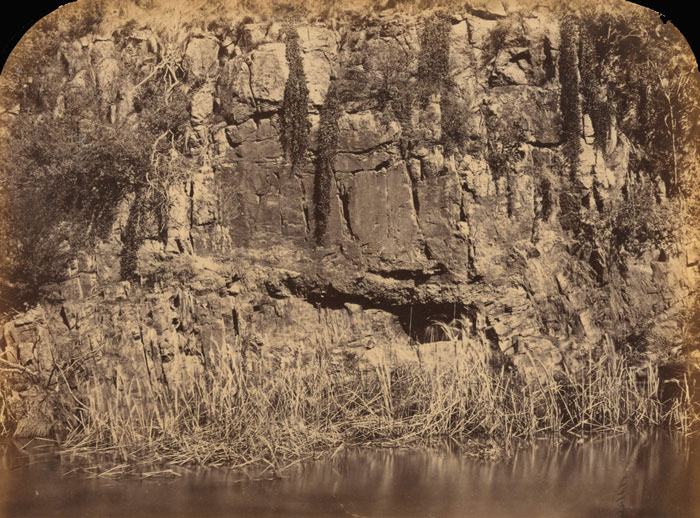
NGV Collection, Richard Daintree: Darley quarries, Bacchus Marsh (Victoria)
Note: Today Darley is a suburb of Bacchus Marsh 50 km north westof Melbourne. It is known for its historic and active quarries. Key sites include the 1860s freestone quarry (associated with early Melbourne buildings) near Goodmans Creek, the Darley Refractories firebrick works (1880s), and the active Boral Bacchus Marsh Quarry on Bonnie Vale Rd, a key supplier of construction aggregates. |
| |
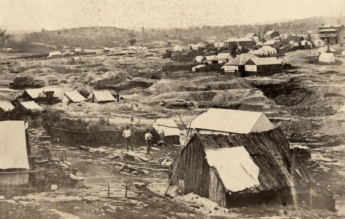 |
NGV Collection, Richard Daintree: Forest Creek, Chewton (near Castlemaine in Victoria)
Chewton, located in Central Victoria on Jaara country, is a historic former gold mining town that emerged from the 1851 Forest Creek rush. The town was officially renamed from Forest Creek to Chewton in 1856. Originally a sheep station, it became one of the world's richest shallow alluvial goldfields, attracting over 30,000 diggers. The town is famous for hosting the December 15th 1851 "Monster Meeting" against high license fees, a landmark for Australian democracy (a meeting of 15,000 plus people).The diggers meteting preceded the Eureka Rebellion.
The town was surveyed in 1854, with the Red Hill Hotel (1854) and Town Hall (1858) becoming key landmarks (both still standing). By the 1860s, shallow alluvial gold was exhausted, prompting a shift to deeper quartz reef mining, which continued for decades. As mining slowed, the population fell from over 3,000 in 1861 to roughly 500 by the 1920s. Today, Chewton is part of the Castlemaine Diggings National Heritage Park, known for its well-preserved nineteenth-century buildings and historic character. |
| |
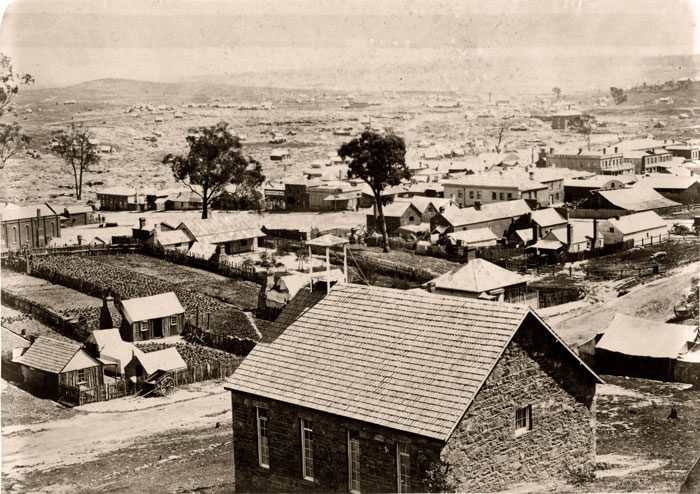 |
NGV Collection, Richard Daintree: Castlemaine (Victoria)
Castlemaine emerged as a premier 1851 gold rush boomtown on Dja Dja Wurrung country. It quickly transforming from a canvas tent city into a major, architecturally rich service centre. Famous for the incredibly rich Forest Creek shallow alluvial goldfields, it became a permanent bustling municipality by 1855 featuring Victorian-era buildings, breweries and foundries.
Following the discovery of gold at Specimen Gully, thousands flocked to the region which was initially known as Forest Creek. It was one of the world's richest shallow alluvial goldfields. Originally a pastoral area in the 1830s, the town was officially named Castlemaine in 1854 likely after Viscount Castlemaine. It was a key administrative centre for the goldfields.
By the late 19th century the town established a solid infrastructure including a railway (1862), the Theatre Royal (oldest continuously operating in mainland Australia), and the Market Building (1862). Beyond mining the town developed a strong industrial base including Thompson's foundry, breweries, and woollen mills.
While it became a city in 1965, the population later declined, causing it to revert to a town. Today, it is recognized for its well-preserved heritage, cultural life, and tourism. The area was originally the territory of the Dja Dja Wurrung people, who were severely displaced by the rapid, intensive mining activities of the 1850s. |
| |
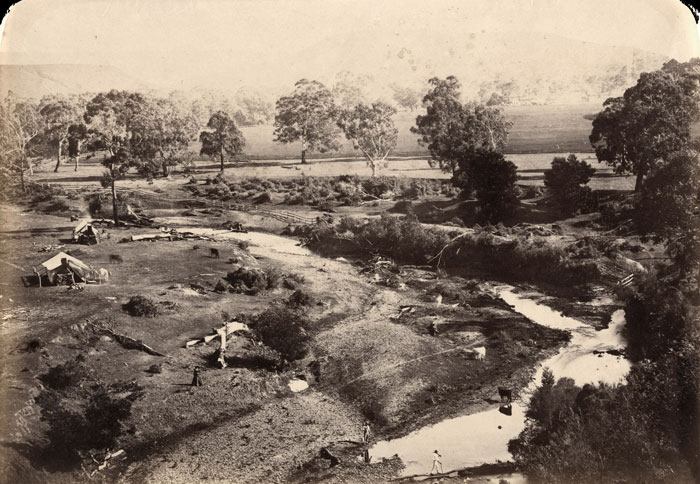 |
| NGV Collection, Richard Daintree: photograph of Richard Daintree's camp |
| |
Return to the main page for Richard Daintree
|